North-west maps


These are the maps for the North-west marine parks.
The maps and data provided should be considered in conjunction with the details contained in the management plan.
Geospatial data
Download resources
- North-west Marine Parks Network (PDF, 26 MB)
- Argo-Rowley Terrace Marine Park (PDF, 528 KB)
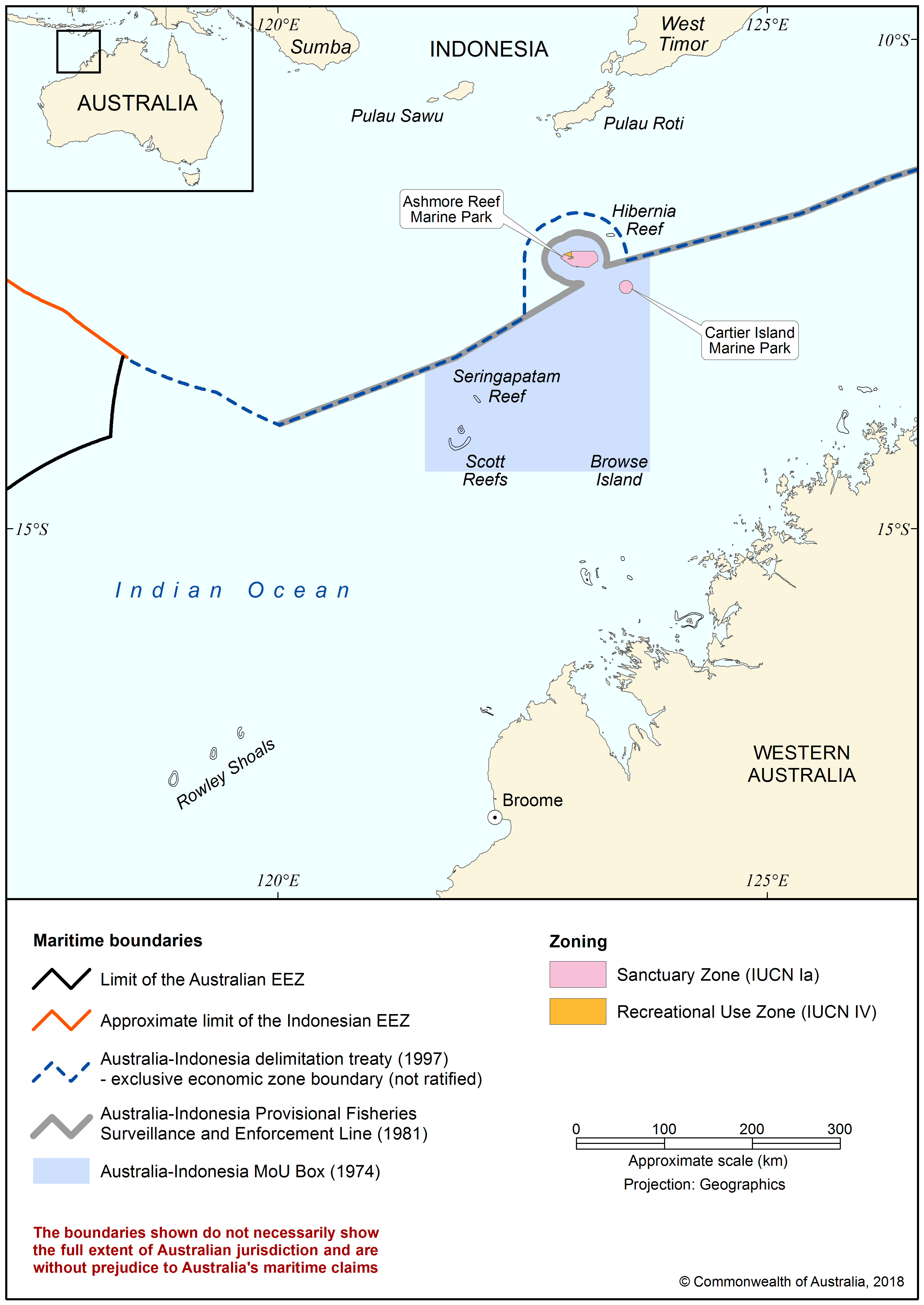
- Ashmore Reef Marine Park (Sanctuary Zone and Recreational Use Zone) (PDF, 267 KB)
- Ashmore Reef map image (PNG, 368 KB)
- Carnarvon Canyon Marine Park (PDF, 184 KB)
- Cartier Island Marine Park (Sanctuary Zone) (PDF, 242 KB)
- Dampier Marine Park (PDF, 212 KB)
- Eighty Mile Beach Marine Park (PDF, 1 MB)
- Gascoyne Marine Park (PDF, 565 KB)
- Kimberley Marine Park (PDF, 2 MB)
- Mermaid Reef Marine Park (National Park Zone) (PDF, 938 KB)
- Mermaid Reef moorings (PDF, 671 KB)
- Montebello Marine Park (PDF, 376 KB)
- Ningaloo Marine Park (PDF, 617 KB)
- Roebuck Marine Park (PDF, 898 KB)
- Shark Bay Marine Park (PDF, 1 MB)
Ashmore Reef moorings
Mermaid Reef moorings


Stay in touch
Subscribe to receive important updates about your marine parks. Enter your email address and click "join now".